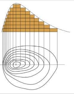
Contour
An imaginary
line, on the ground, joining the point of equal elevation above the assumed
datum, is called contour.
Contour interval
·
The vertical distance between two consecutive contours is known as
contour interval.
·
Number of contour line are more in hill as compared to the plains or
same contour interval.
·
It depends upon SANAPA
·
Where, S= scale of map, A= Availability of time and fund, N= Nature of
ground, E= extend of survey, P= purpose of map and A= amount of permissible
error.
·
Contour interval= 20/No of centimeter per km
= 50/No of inches
per mile
Contour gradient
·
The imaginary line lying throughout on the surface of the earth and preserving
a constant inclination to the horizontal.
·
It is either rising gradient or falling gradient.
Horizontal Equivalent
·
The minimum horizontal distance between two consecutive contours.
·
Numerical value of horizontal equivalent in hill is less as compared to
the plains.
Interpolation of contours
·
Process of drawing contours proportionately between the plotted ground
point or between plotted contours.
Method of contouring
1.
Direct method
2.
Indirect method
1. Direct method:-
·
The contour to be plotted is actually traced on
the ground only those point are surveyed which happened to be plotted.
·
This method is slow and tedious.
·
It is generally used for small area and where
great accuracy is required.
2. Indirect Method:-
This have three type
1.
By squire :- for low undulating area
2.
By cross section: for road cannel, railway
e t c
3.
By tachometric: for high undulating area.
Uses of contour
·
Drawing of the section
·
Selection and location of road
·
Determination of inter-visibility between two points.
·
Measurement of catchment area.
·
Calculation of reservoir capacity.

